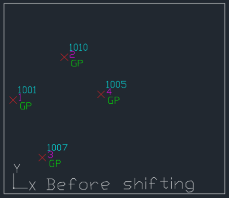
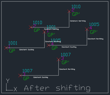
Rotation of Data
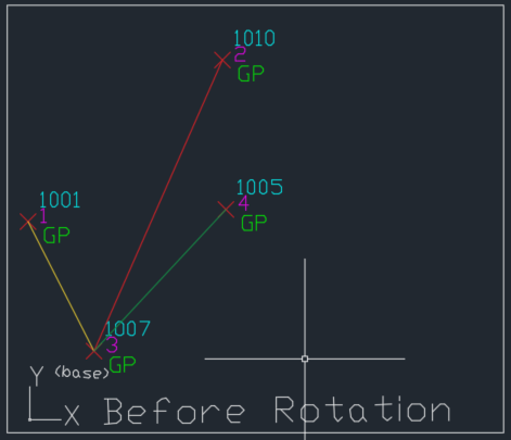
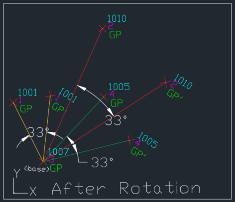
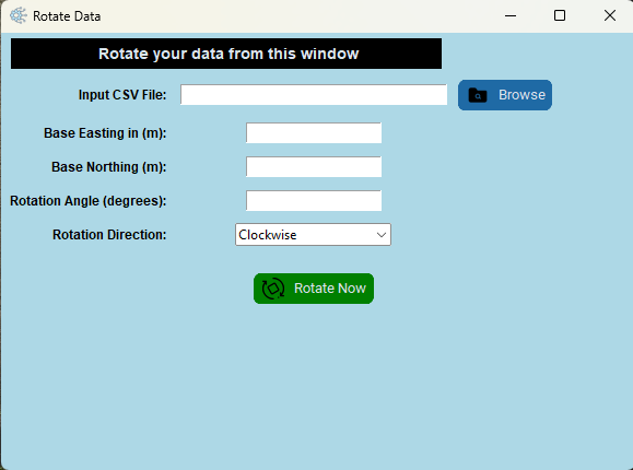
This feature enables users to rotate their surveyed coordinate data (northing, easting, elevation) around a specified base point. This is particularly useful when aligning surveyed data with Google Earth overlays. To determine the rotation angle, users can identify two common points between their surveyed data and the Google Earth overlay. By measuring the angle difference between these points in Google Earth, users can calculate the required rotation angle for their coordinate data. Please note that the rotation angle is measured in degrees, and all coordinate values must be in numerical format before applying the rotation. Ensure that your CSV file containing the coordinate data is formatted accordingly.
CSV Format:-
To perform a coordinate Rotation the input data must be in CSV format. The CSV file should contain the following columns in order: Serial Number, Easting (numeric), Northing (numeric), Elevation (numeric), and Remarks. Ensure that all numerical data (Easting, Northing, and Elevation) is in a consistent numeric format for accurate processing.

UNDERSTANDING INPUTS:-
To rotate your data, you'll need a CSV file formatted as previously described. First, specify the base easting and northing coordinates around which the rotation will occur, as well as the rotation angle in degrees. Then, browse for your CSV file, enter the required credentials, and initiate the rotation process. Once the calculations are complete, you'll be prompted to select a location to save the rotated data as a new CSV file.